
Tahiti 🇵🇫 bound 🏖🌞 ~ Part 4
Well, today was what to be the high point of our entire trip… We were returning to Bora Bora after 35 years. We were Read More ...
“The world is a book and those who do not travel read only one page.” – St. Augustine


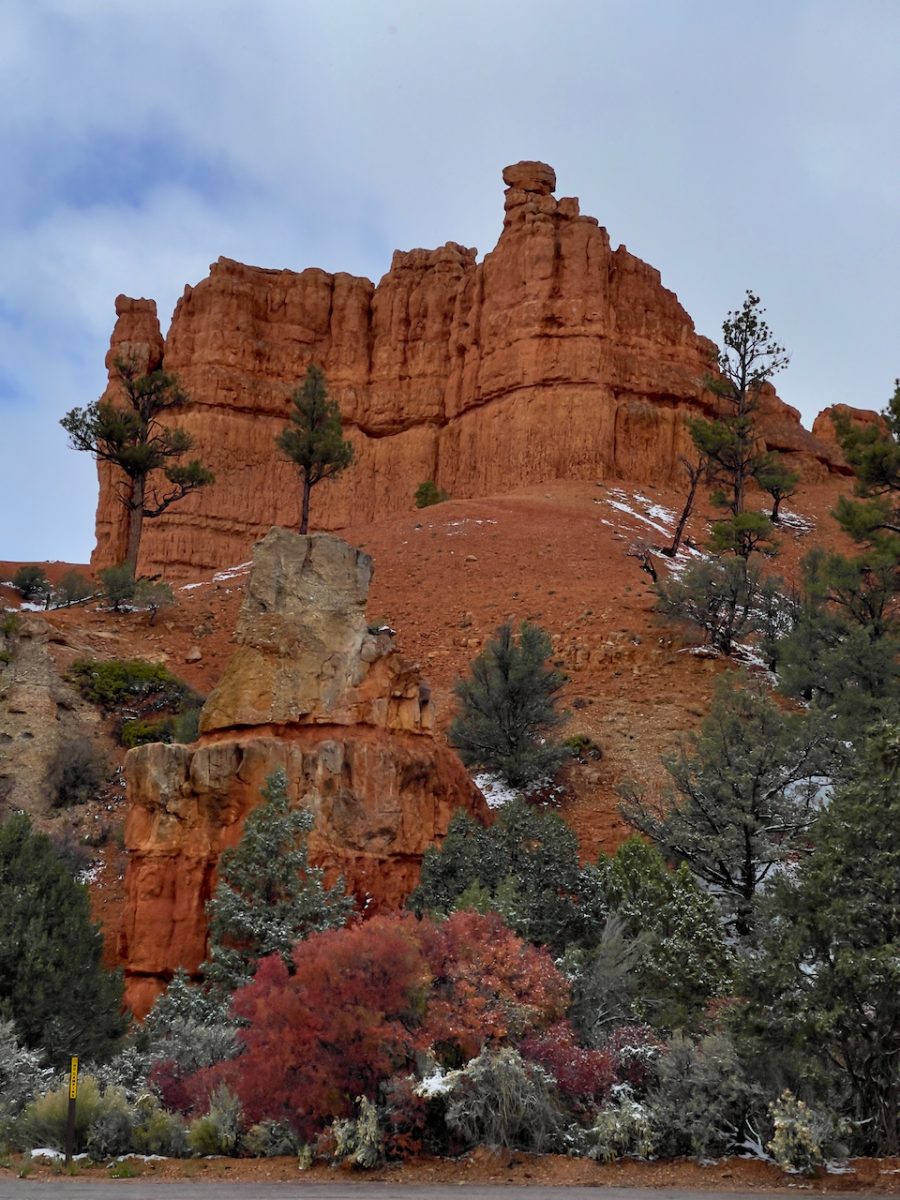
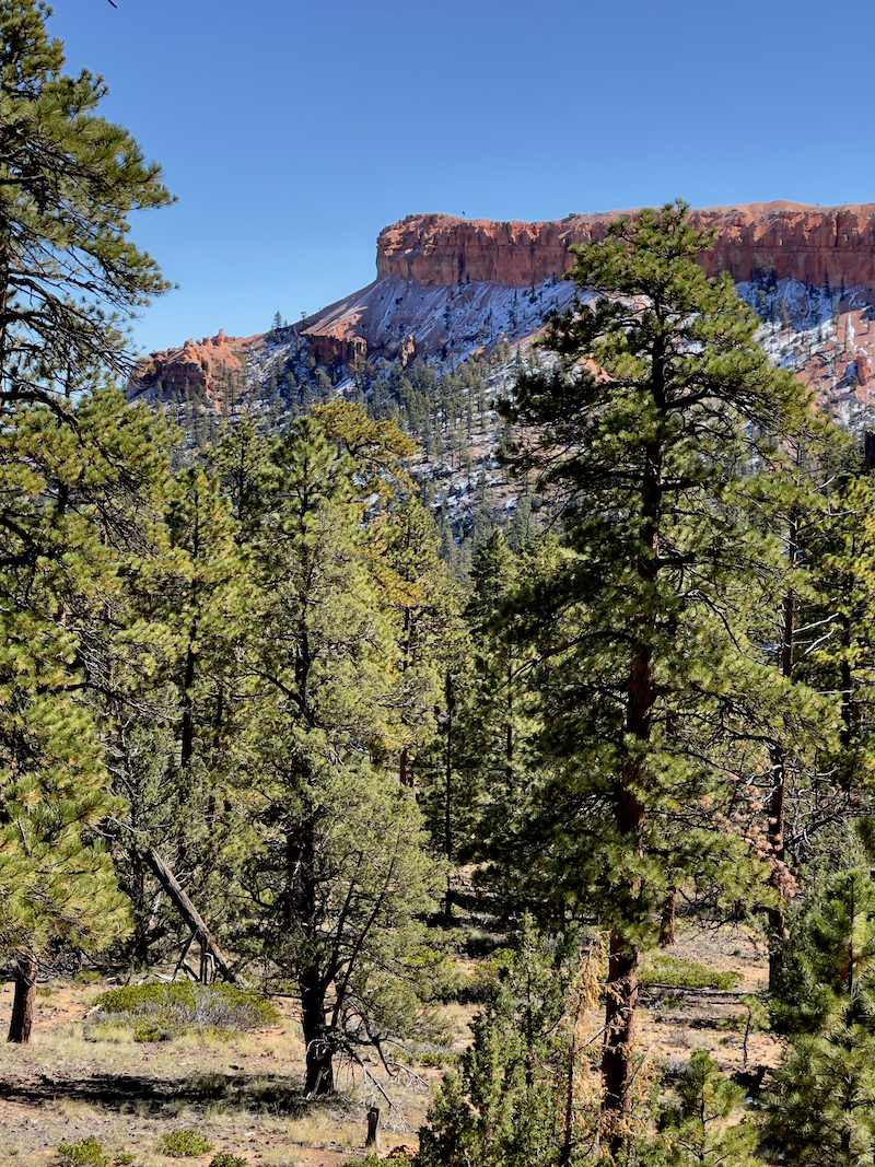
The cold weather storm passed through Springdale/Zion on Monday night and left the cliff tops and pine trees covered in snow affording us a totally different view while departing Zion.


Temperatures were in the teens and the scenery on our drive to Bryce Canyon was made even more spectacular with the contrast of the red, red mountains with the white snow.


Upon arrival at the hotel – cold, blowing wind, ice and snow everywhere.
Bryce Canyon is hugely different than Zion in so many ways. Bryce is a much more camper/RV oriented location being that there are only 2 hotels to speak of in Bryce Canyon City. The lodge inside the park is old and caters mostly to tour busses and groups.
There are no restaurants to speak of either. Ruby’s Best Western lodge is massive and also caters to groups and tour busses. They have a general store and a cowboy country buffet. 🙄
The park itself is much more spread out and cars are permitted in the park. Their shuttle is very limited in that it only serves the upper portion of the park around the Amphitheater. The lower part of the park to Rainbow Point that is not served by the shuttle usually closes in the winter after the first measurable snow storm.
The lower portion of the road to Rainbow Point was closed for snow clearing on the day we arrived and we were unsure when it would reopen.

Bryce Amphitheater – Oct. 13
There were such incredible contrasts between Zion National Park and Bryce Canyon. Not only because of the snow, but the fact that in Bryce Canyon National Park we are at the top of the canyon looking down vs Zion we were IN the canyon looking (and hiking) up. So driving up and down the park roads one only sees flat land and trees around them. It’s only when you hike out to the edge of the canyon from the parking lots that you experience the canyons below you.
Today we had intended to drive to the very end of the park to Rainbow point (18 miles) and work our way up the canyon but the road was closed at mile 3 because of the 6” of snow they received.
We were told that normally this kind of snow doesn’t happened until the end of October. But the snow storm ended up being a special treat for us because the snow tucked in to the hoodoos added so much beauty to the park.
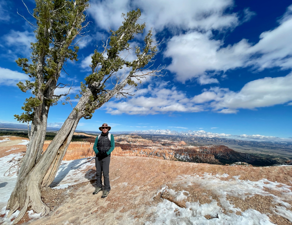
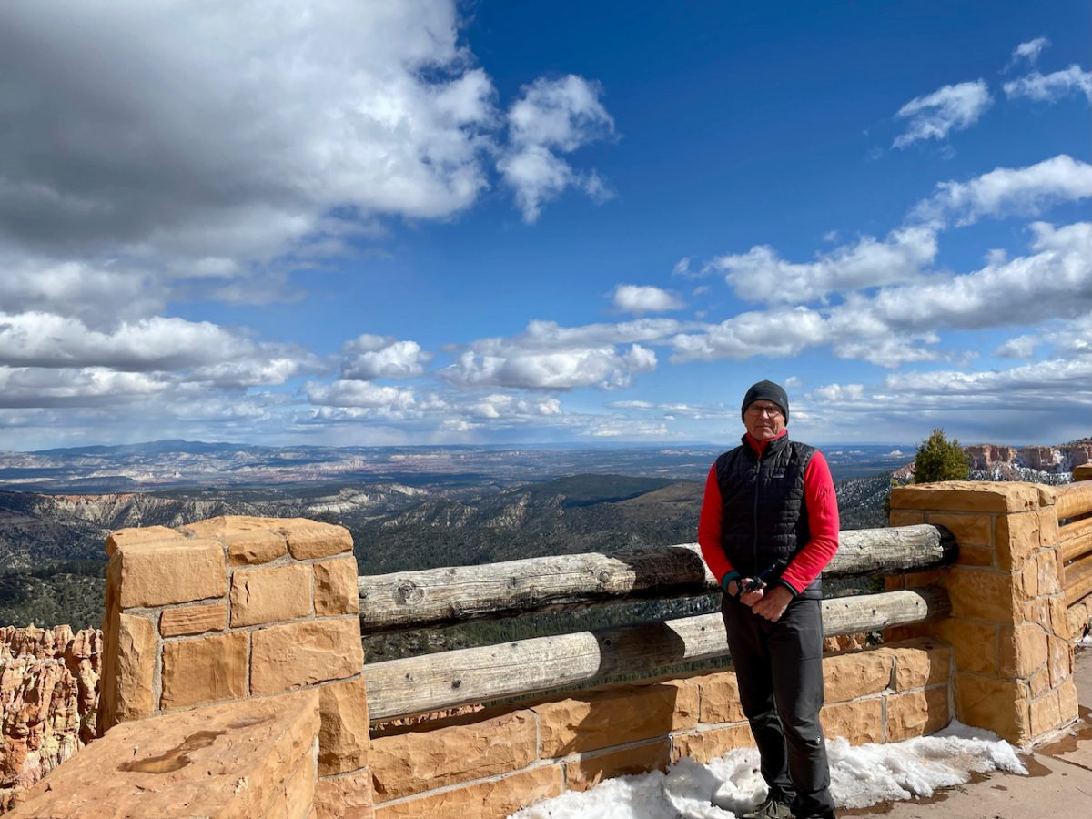
The weather was cold and we were grateful for all our layers we brought. Well, except that Joe forgot his parka so ended up using a spare fleece jacket (salmon colored in photos) I had brought along. Thank heavens it wasn’t windy.
Paria lookout was our first stop today and it knocked us off our feet.


We had endless views to the Escalante/ Grand Staircase in the far distance.
After driving to our first stop at Paria Lookout, and encountering closed roads by Park Rangers because there was no parking available, we ended up going back to the visitors center, leaving our car in the parking lot and taking the park shuttle instead.
The shuttle wasn’t as well organized as in Zion, but it worked well enough for us to get us around. One thing that as pretty cool in the park was that they had an app (and we had enough mobile reception) that tracked when the next shuttle bus would be where. This was very helpful as the busses only ran every 15-20 minutes. Plus, trail conditions permitting, one could hike one way between two points with the knowledge that there’d be a shuttle to transport you to your next destination.
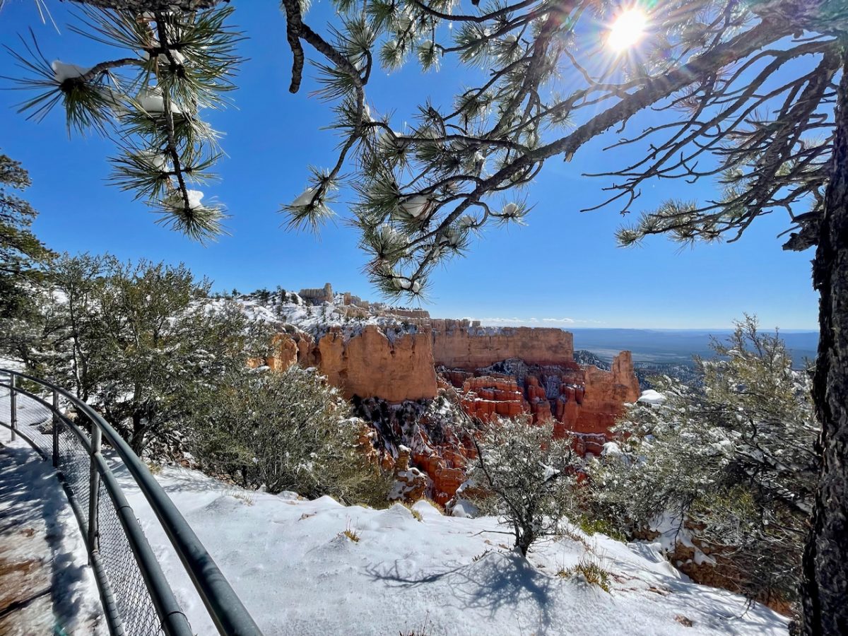
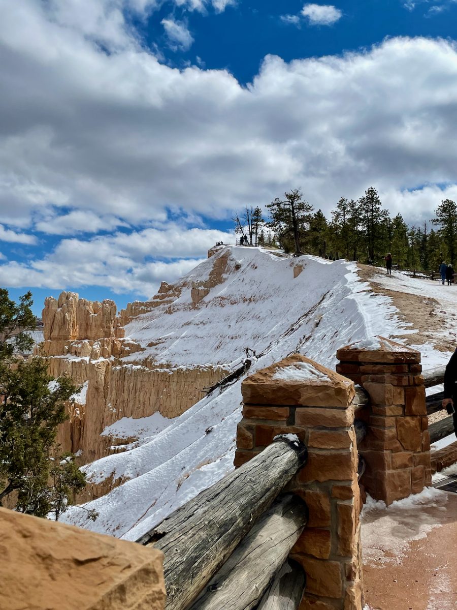
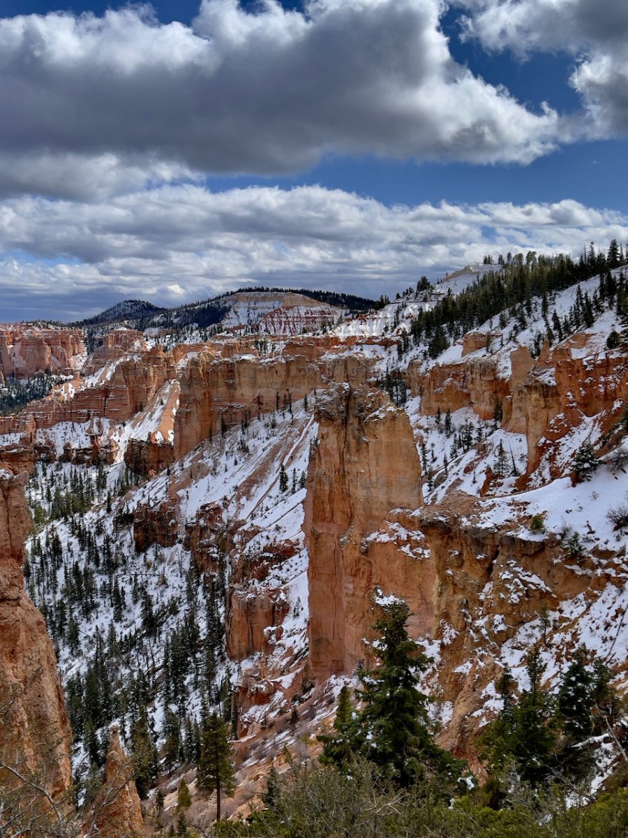
The viewpoints are really well done with multiple outlooks. BUT it was SUPER slippery because the snow was either slushy and muddy or slick solid ice making the trails very hazardous. The views down in to the canyon from the viewpoints were magnificent. If you look carefully in some of them you can see some of the hiking trails.
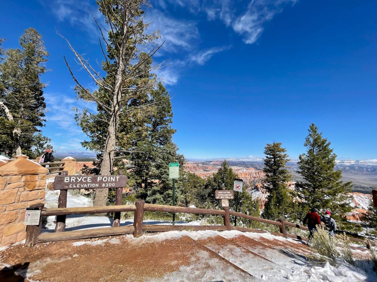
Our next stop was Bryce Point. It’s the southern most edge of the amphitheater so one looks north towards Inspiration Point, Sunset and Sunrise point. This is where the majority of longer trails can be found inside the park.

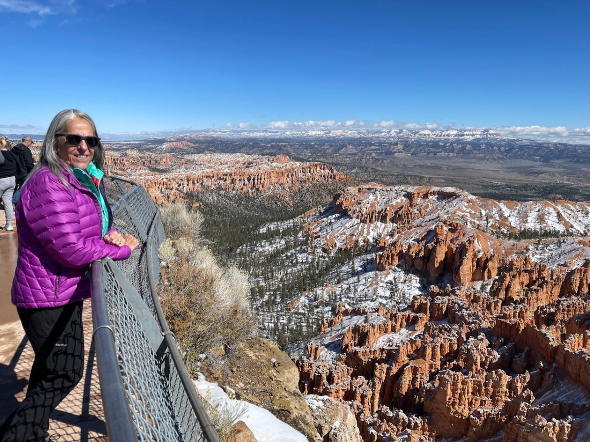
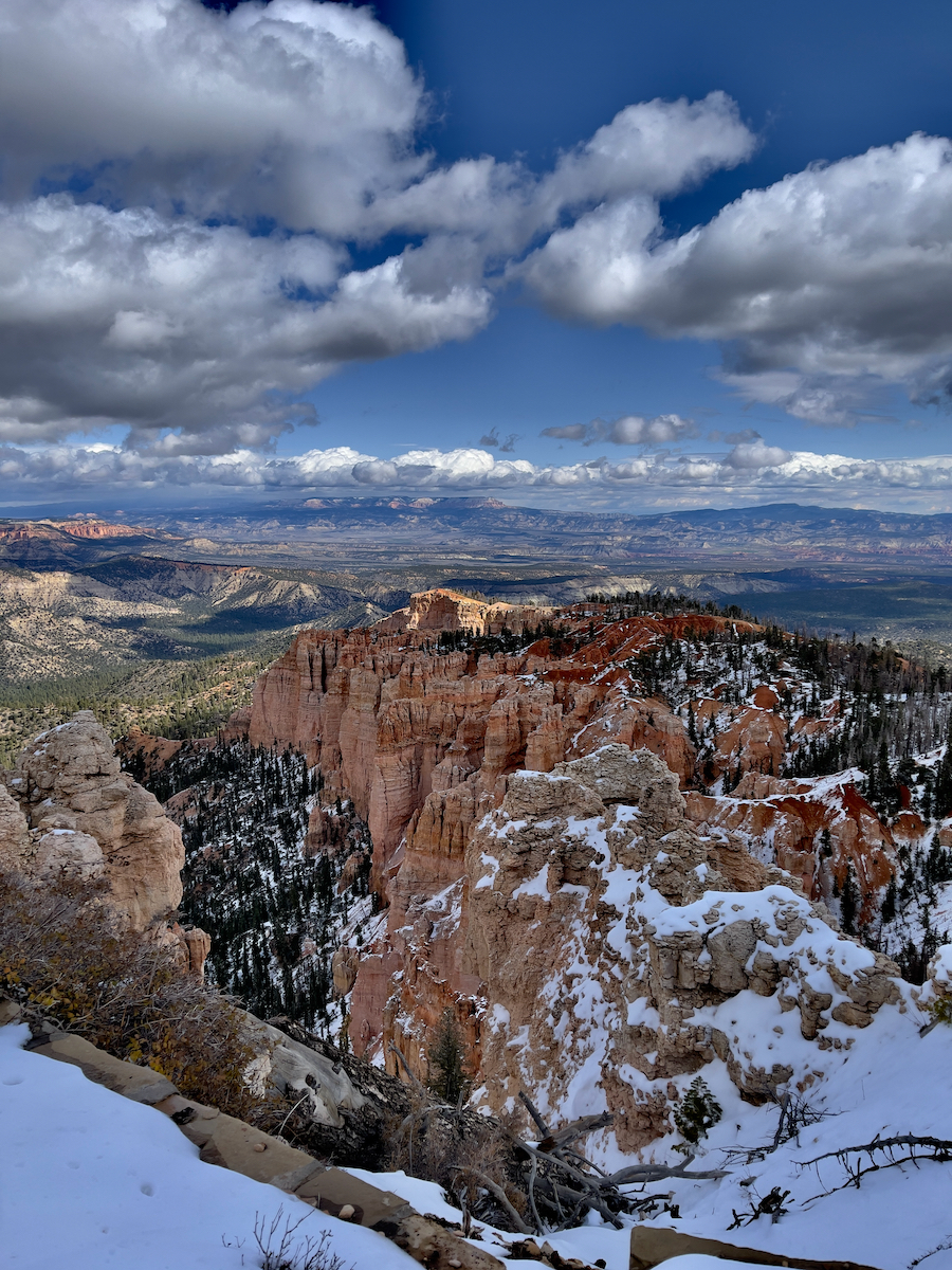
These spectacular photos give you somewhat of a feeling as to why they call this upper part of Bryce Canyon National Park an amphitheater. You are looking down (major toe tingler for Lisa) in to the vast canyon coming together on all sides.
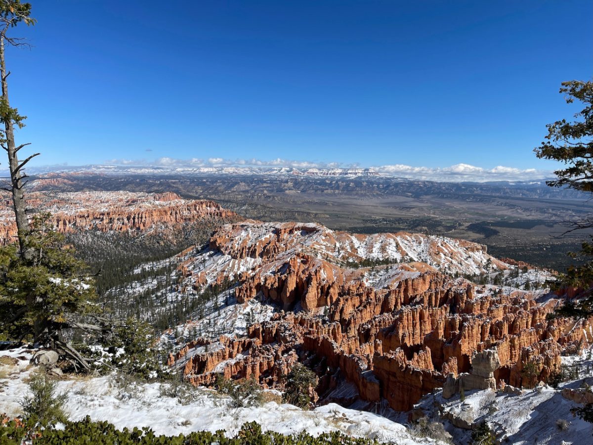


The most popular section of Bryce Canyon National Park is called the Amphitheater. After looking at these photos one can understand its name and get a feeling of how vast the National Park and its views are.
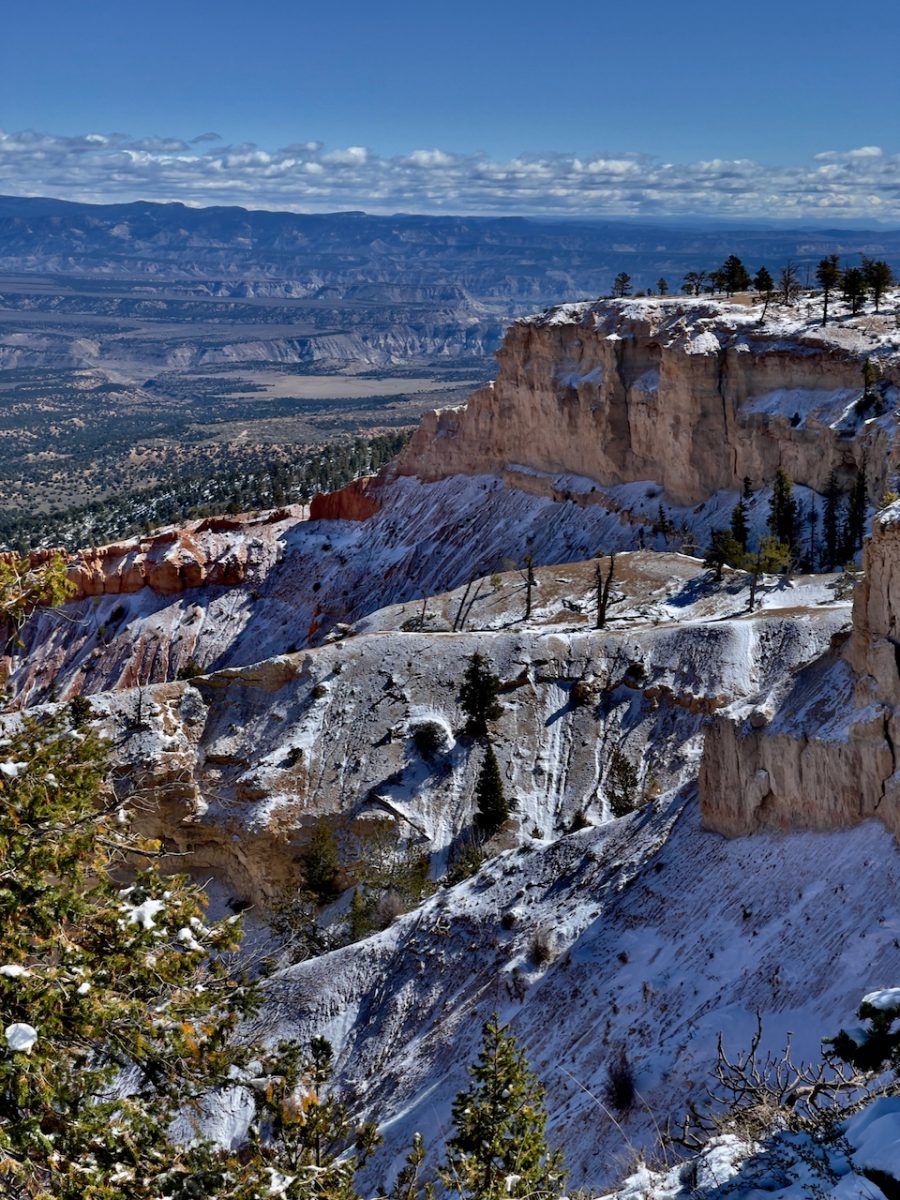
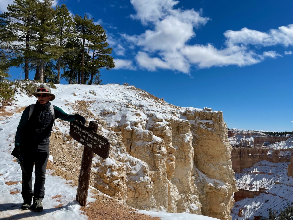
Our next stop was Inspiration Point where we ever so carefully took the connecting trail and worked our way up from Lower Inspiration Point to Middle and then Upper Inspiration Point look outs. One has three opportunities to be “inspired” (if you can slip and slide your way to each of the 3 viewpoints). The views continue to be breathtaking though different from each viewpoint. Each had their own unique view because of the direction it faced. … south to the border of Arizona and the Grand Canyon or eastward to Escalante/Grand Staircase and Colorado.
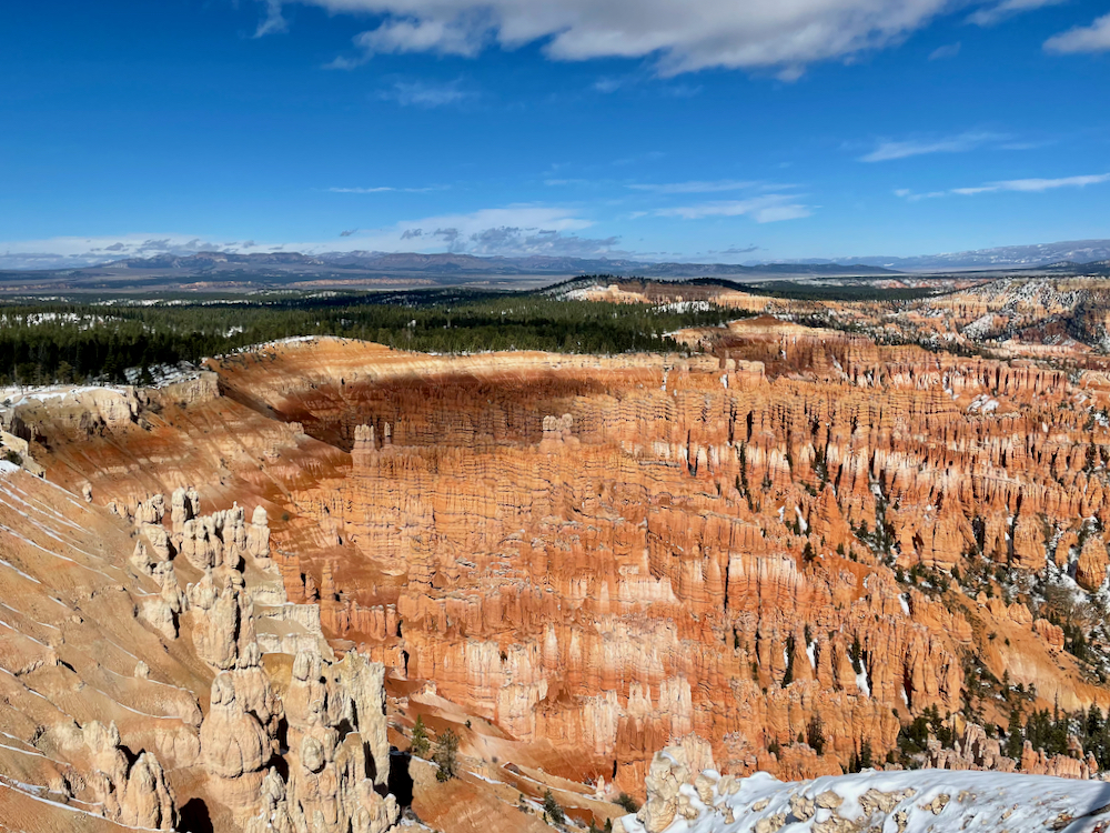
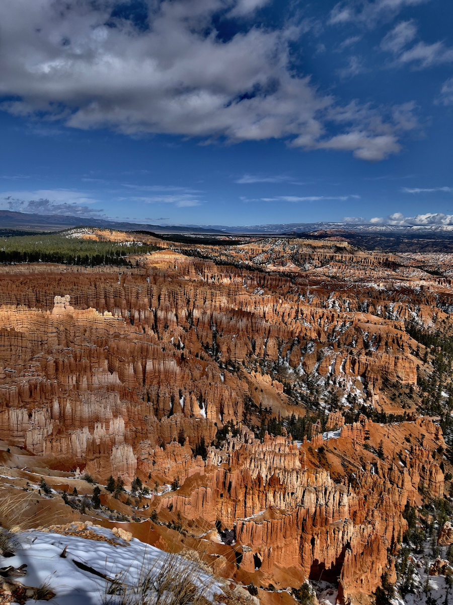

The snow tucked in to the hoodoos added so much to the day. We really lucked out with the weather as though it was cold, it was super clear and the skies were blue, blue, blue.
If you look down in to the canyon you can make out some trails. We’ll do one in to the Canyon in a day or so. It’s REALLY far down!!
From time to time rocks come loose and tumble down the edge…
The snow really added to the experience… and in a few days it will be gone. …as will we on our way to Arches and Canyonlands National Parks.
After a short stop for a picnic lunch at Upper Inspiration Point we continued on Sunset Point.


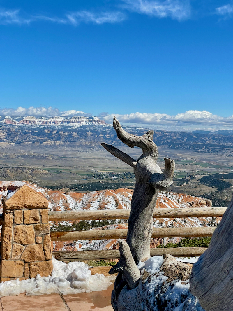
This photo with the dead tree limb at the edge of the canyon is looking down in to Navajo Trail to a portion that’s called Wall Street. The name is because it’s all narrow walls of hoodoos that you hike through.
We’ll be hiking this trail in 2 days time.
Look carefully in one of the crevasses and you’ll see a super tall pine tree growing in the middle of it. This gives you an idea of how super deep this canyon is.

The two optimal photography times are at sunrise and sunset. Depending on which direction one is looking the rising – or setting sun casts its light on the hoodoos for a spectacular sight.

Being that we’re not early risers we only sought out the sunset photo ops. ☺️

Lower Bryce Canyon – Oct. 14
The park is basically broken in to 2 parts. The upper consisting of the Bryce Canyon Amphitheater in the first 3 miles of the park that we visited on Wednesday with the shuttle bus and the lower section — mile 3 to 18 is not served by the shuttle and closed in the winter.
This section was closed for plowing the 6” of snow when we arrived until Wednesday afternoon.
Today we started at mile 18 – Rainbow Point and Yovimpa Point. It’s the highest altitude in the park at 9,115 ft. and on a clear day like we had you can not only see the Grand Staircase-Escalante National Monument but also south to Arizona and the edge of the Grand Canyon!


We hiked / slipped and slid / skated / snow trekked on the beautiful Bristlecone Loop Trail. We would have been down more (on the ice) than up without our hiking poles. There were short parts of the trail that had benefited from the sunshine and so the ice/slush had melted. More frequently we walked in the snow for better traction than on the icy trail.


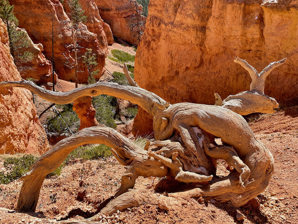
The Bristlecone pine trees are the heartiest pines that can withstand not only drought but the conditions here in the park. Some are over 100 years old. Many look dead but upon closer inspection one can find a new growth springing out which will grow around the dead part. I fell in love with them as they were so artistic. You’ll see many photos of them in this BLOG of our hiking trip.

Clever travelers that we are we filled one of our hydro flasks with boiling water in the morning so we were able to manage a nice hot cup of noodles to warm us up instead of a cold sandwich for lunch.
Then we made our way back up the park stopping at all the lookouts to enjoy the views on the way back to the beginning of the park. Each stop afforded us yet more stunning and different views.
Natural Bridge (below) is an 85-ft rusty orange arch that formed at the upper edge of the canyon. Natural Bridge is really a misnomer as it was formed over millions of years by wind, water and chemical erosion.


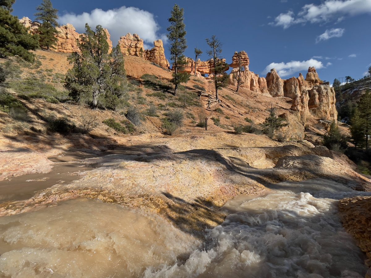
On our way to the town on Tropic off the 12 for our afternoon coffee at the ONLY true coffee shop in the entire area we stopped for a very short hike at Mossy Cave.
It was written up as having great hoodoos, a cave (with moss) from the stream in the area, and a waterfall.

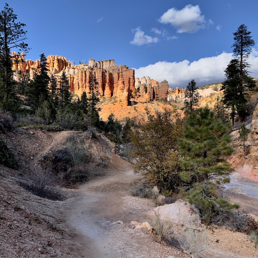


The afternoon light was just perfect for this short 1.5 mile hike.


Navajo/Queens Garden Trail
– Oct. 15
Friday was our last day in Bryce Canyon. We chose a fairly long hike that would take us IN to the canyon area we had been looking down on for the past two days. It would give us a different perspective.
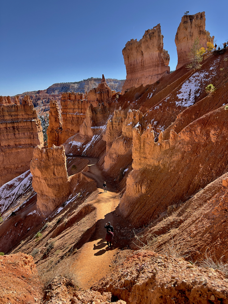
It would be about 5 miles by the time we completed it all. We started at Sunrise point going down Queens Garden trail and then we would take the Navajo trail Wall Street side UP to Sunset point. From there we would take Navajo trail Two bridges/Thor’s Hammer trail down almost to the bottom at Two Bridges before making our way back up to Sunset point to finish.


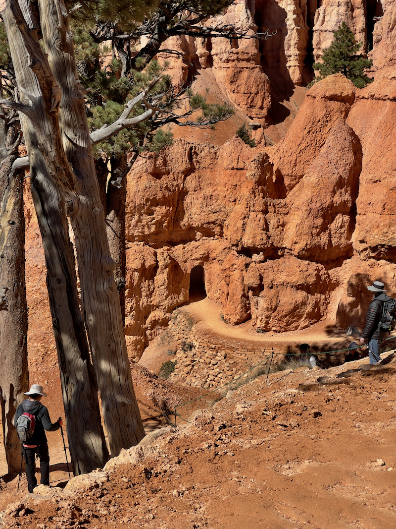
The scenery was very different as there was actually very little plant life. Bristlecone pines clung to the steep edges of the trails. The downhill portion of the trail was lots of switchbacks winding our way down, down, and down through a number of sandstone gates. (tunnels through the sandstone).


Today our views were in reverse. We were making our way to the bottom of the massive canyon and would be looking way up at the steeple-like hoodoos and the park main road.


We hiked down to the bottom of Queens Garden trail and the scenery changed again. It was almost like walking through a forest floor (see photo above).

Then the hard part of the hike… climbing back up. We connected to Navajo Trail and made our way through a section called Wall Street because of it’s very narrow super tall walled sections of sandstone that made you feel like you were in New York with skyscrapers all around you.
…and now we start climbing steep steps through narrow cave canyons
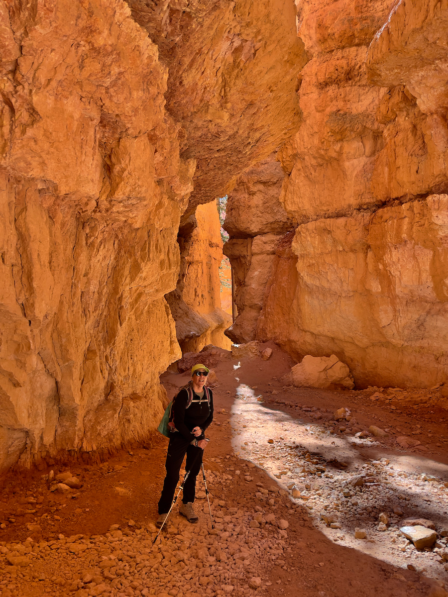


…then the trail turned in to slippery muddy steep switchbacks that reminded us very much of Walters Wiggles at Angel’s Landing in Zion. When I say muddy I mean our hiking boots soles were sinking in to the mud and filling the treads that we lost all traction to the point that it felt like we were ice skating uphill. Once again, thank heavens for our hiking poles.

We made our way to the end of Navajo Wall Street trail at Sunset point. We had incredible views in the spectacular afternoon light. We wanted to get a closer view of Thor’s Hammer hoodoo and see the two bridges that were at the bottom of the 2-bridges Navajo trail. The descent was much drier and not muddy. Although we had more Walters Wiggles like switchbacks on this side of the trail also, just not as muddy.


Thor’s Hammer hoodoo required massive imagination to depict the namesake.
We made it to the relatively unremarkable 2-bridges (photo of me sitting infront) where we turned around and made our way back up the Navajo 2-bridges portion of the trail.

Tomorrow is on to Moab where we will visit Arches and Canyonlands national Parks traveling on the scenic Highway 12 through Escalante Grand Staircase National Monument.

Follow us on our journeys (mostly by water) over the years starting in 1999. Digital photography had just come out in 1999, the year we Read More ...

We had 2 trips planned for 2023. The first one was to Paris and Amsterdam for the special Vermeer exhibition at the Rijksmuseum. In June Read More ...

We still weren’t comfortable traveling at the beginning of 2022. COVID was still very present and traveling on a plane for long international flights was Read More ...

The COVID-19 Pandemic continued to impact our lives, while we anxiously waited for the vaccination program to become available to the U.S. population. Again we Read More ...

This year started out at the beginning of January with a 3+ week cruise to French Polynesia. We were tired of the winter weather and Read More ...

This year was a year of two wonderful trips. Our first trip was nearby to Monterey for hiking, brew pubs, and visiting the Monterey Aquarium. Read More ...

This year was a year of travel and finishing the remodeling of our house. Click here to view reverse chronological entries for 2018. You can Read More ...

2017 had two major events in our life. One was the Tubbs fire on the 9th of October, that forced us to evacuate our home Read More ...

2016 was a busy year for us. The extension remodel was completed in January. We flew to London for Sophie’s wedding in February. We hiked Read More ...

The year was filled with discovering a new hobby for us … hiking. We took some classes at Pt. Reyes National Park, hiked (literally) in Read More ...

Our adventures continued along with some amazing changes for us during 2014. The New Year found us on the last portion of our Antarctic cruise, Read More ...

Our year kicked off with the annual cousins gathering. We returned to France around the middle of April. We hauled JoLi’ Folie out in June for Read More ...